India-US Satellite Spots Antarctic ‘Hummingbird’
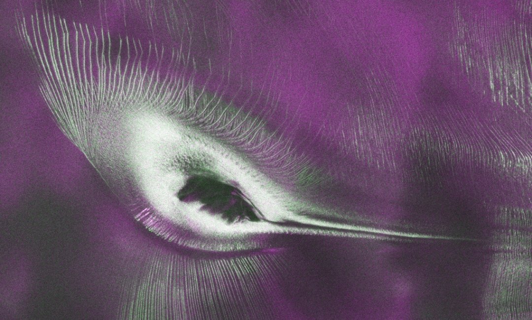
WASHINGTON, DC-A joint US-India Earth-observation satellite has begun releasing data from both its radar instruments, offering scientists a new view of changes across the planet, including an Antarctic landscape that resembles a hummingbird.
Public access to data from the NASA-ISRO Synthetic Aperture Radar (NISAR) satellite opened on July 20. Teams in the United States and India will continue releasing processed files from its L-band and S-band radars, NASA said in a media release.
The data will help researchers track the movement of land and ice, monitor forests and wetlands, and respond to natural hazards such as earthquakes and landslides.
The release comes nearly a year after NISAR’s launch from ISRO’s Satish Dhawan Space Centre on July 30, 2025. Since then, mission teams have calibrated the instruments and refined processing algorithms ahead of the public data release.
NASA on July 21 released an early image showing Nunatak Zaterjavshijsja, a mountaintop in East Antarctica, rising amid ice flowing northeast toward the ocean. The fractured landscape forms the outline of what appears to be a hummingbird.
As the glacier moves around the mountain, the topography creates stress in the ice. Deep crevasses appear as sharp green lines in the radar image, while smoother ice surfaces appear magenta.
“First, it’s a beautiful image, with rich details of features that provide insights to how the glacier is moving. Then, because radar can often see through snow and deep into the ice, NISAR can observe fundamentally different properties of Antarctic ice than can be seen in optical imagery,” said Seongsu Jeong, signal analysis engineer at NASA’s Jet Propulsion Laboratory in Southern California, who produced the image.
“With NISAR we’re seeing what’s hidden beneath the surface.”
The image was generated from L-band measurements collected in August 2025 while NASA and ISRO teams were testing the satellite’s systems.
ISRO’s Space Applications Centre in Ahmedabad has begun releasing S-band data through the Bhoonidhi portal, while NASA has started releasing calibrated L-band products.
NISAR is the first satellite mission jointly developed by NASA and ISRO. Using synthetic aperture radar, it can collect observations through cloud cover and darkness, enabling scientists to monitor land and ice movement and detect changes caused by earthquakes, landslides, floods and other natural events. (IANS)